The recently-demolished gas holder was part of the former East Greenwich Gas Works
If you’re still mourning the loss of the gasholder next to the Blackwall Tunnel, which was finally dismantled last year, and curious about the old gas works that used to stretch out across the Greenwich Peninsula, then you can find out more this weekend with an online talk from local historian Mary Mills.
The Zoom chat is part of the Charlton Society‘s monthly programme of Saturday talks, which would normally take place at Charlton House, but has been running virtually during the pandemic.
The early gas industry was a hotbed of fraud and scandal – and the scandals around Greenwich’s first gas works led to the collapse of the ruling party and resignation of the Town Clerk in the 1820s. There were other gas works in Woolwich – with more scandals – even one in Eltham. Eventually, as everyone knows, Greenwich ended up with the biggest, the latest and the most perfect gas works ever – plus, of course, the recent scandalous demolition of our largest-in-the-world gas holder.
Mary Mills, well known to our regular members, has been around in Greenwich for years and it was while working at Charlton Library in the 1970s that she became hooked on local industrial history and has written a lot about it since. She was one of the founders of Greenwich Industrial History Society and has a PhD in the history of the gas industry.
The talk begins at 2.15pm on Saturday for a 2.30pm start and is open to both members and non-members – you can join the session here.
To find out more about The Charlton Society’s talks and how to join, visit charltonsociety.org.
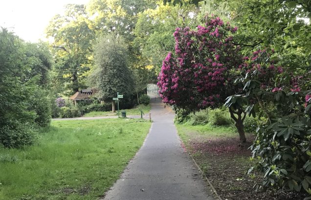
A project for benches in Maryon Wilson Park is seeking £4,602
Projects across Charlton could be in line for council money from the Greenwich Neighbourhood Growth Fund – with residents given the chance to vote for which schemes get money.
The cash comes from a levy on developers, and £50,000 is available across Charlton, Woolwich and part of Kidbrooke.
Unlike previous GNGF votes, any resident in any part of the borough can vote for any project, with final decisions to be taken at area meetings with ward councillors after the poll.
Projects in Charlton – and very close by – up for funding include a plan for a new playground and picnic area in Charlton Park, benches for Maryon Wilson Park, work to restore the Long Borders at Charlton House a mural under the Woolwich Road flyover.
Local projects you might want to support are:
Area 3: Friends of Charlton Park / £27,051
Proposal to provide Charlton Park Playground with a new picnic area with shady trees, a drinking fountain and extra picnic benches that will bring new life to a run-down corner of the play park. Local families want to see the playground transformed to a landscaped natural adventure that sparks the imagination of children. This space will provide park users somewhere to sit and share picnics in natural shade on hot summer days.
Area 3: Friends of Maryon & Maryon Wilson Parks / £4,602
Installation of two picnic benches adjacent to the Triangle as a meeting point for the community and for parents and carers.
Area 3: Charlton & Blackheath Amateur Horticultural Society / £5,000
Revival of Charlton House Long Borders Garden. Recreation of the Long Borders area for wider community use to include plant and creative fairs, farmer’s markets, outdoor theatre and seasonal events.
Area 3: Luke’s Parochial Church Council / £11,051
Enhancement of the churchyard, highlighting historical features, install attractive and imaginative planting, providing benches to facilitate reflection, enhance safety by levelling the path. Eliminating trip hazards.
Area 3: St Thomas, Old Charlton PCC / £10,000
Renovation of the St Thomas’ Upper Hall for the wider community’s use as a hub. To include re-plastering, painting, recovering of the floor, creating a more welcoming and comforting space.
Area 3: Clockhouse Community Centre with New Charlton Community Centre (NCCA) / £47,227
To make significant building improvements the New Charlton Community Centre (NCCA) to the house and hall (including the installation of a disabled bathroom, redecoration of the hall and to clear and install an all-weather surface externally to improve the external areas to ensure the NCCA is further fit for purpose to serve the local community. To additionally replace some dilapidated kitchen equipment in the Clockhouse Community Centre to significantly improve the services offered by the Community Cafe.
Projects close by… (Area 2 covers the Greenwich Peninsula so has £140,000 on offer)
Area 2: Montessori Education for Autism, Westcombe Hill / £5,617
Erect a 6′ x 6′ wooden greenhouse and a 6’ x 6’ wooden potting shed to provide enhanced learning opportunities for children with autism and other disabilities.
Area 2: Invicta Primary School / £65,000
The creation of a bespoke play space and cedar clad meeting room (capacity: 15 adults) to provide an outdoor library for children, music lessons, staff meetings, and a conference space for community hire.
Area 2: Aldeburgh and Fearon Streets Neighbourhood Watch / £7,500
To improve the area under the Angerstein flyover by commissioning a mural that would represent some aspects of the history of the area, as well as its reality today.
Up to 1,400 homes could be built in a proposal that would link Greenwich Millennium Village and existing communities in east Greenwich after nearly a quarter of a century. Details are sketchy, but London Square promises to “transform the existing site and create a new neighbourhood that will deliver new homes, cafés, shops and new pedestrian-friendly spaces, including a new public square at the heart of the site”.
Most buildings would be around seven or eight storeys, but some could be up to 20 storeys tall. Car parking for Ikea and the Odeon would be below the development, potentially on the ground floor. The development site does not include the Sainsbury’s petrol station left over from when the supermarket moved to Gallions Road in 2015.
The site is currently a 1,000-space car park
“We are working to agree a temporary parking solution with Ikea for the construction period,” the developer says. Work on the scheme could begin in spring 2023.
Nearly a quarter of the homes – 24.5 per cent – would be for London Affordable Rent, about half market rent, with 10.5 per cent being for shared ownership. Like most major new developments in the area, it would be car-free, with residents banned from obtaining parking permits.
B&Q last spring: the DIY chain’s lease is running out
The developer plans a “green shield” to protect the development from the adjacent A102, which is likely to be also carrying Silvertown Tunnel traffic when the development is finished. It says it will “comprise a mix of trees, planting, a living wall and building massing adjoining the Blackwall Tunnel approach, that will protect the site to the north from the pollution and noise created by this busy route”.
“The development will serve as an ecological bridge between the suburban gardens of Westcombe Park and the green spaces within the Greenwich Millennium Village Ecological Park,” the developer adds in the consultation.
A similar principle is used nearby where blocks in Greenwich Millennium Village are designed to shield residents from the aggregate works at Angerstein Wharf.
The site has been a retail park since 1999, when Sainsbury’s opened its ill-fated “eco-store” on the site, with the cinema and other retail following after that. Ikea replaced Sainsbury’s two years ago. Before the site became a retail park, it served as a sports club for the nearby gasworks, before the Metrogas club moved to Avery Hill in 1989.
Two months ago, Greenwich councillors approved detailed plans for the final phase of Greenwich Millennium Village, backing plans for 489 homes on a site across Bugsby’s Way from B&Q and Ikea.
The developers promise new retail space in the scheme
The scheme could potentially form a template for redeveloping the Charlton retail parks to the east of the site. None are currently in line for development, although a recent council planning document suggested the Makro site off Anchor and Hope Lane “should accommodate a mix of small and medium sized commercial, retail, leisure and community uses and flexible SME space”.
Residents in Eastcombe Avenue regularly complain of rat-running traffic
Greenwich Council says it will monitor the effects of closing Westcombe Hill to through traffic on neighbouring streets in Charlton and take action if necessary.
Maze Hill has been particularly badly hit since the upsurge in traffic following the first wave of the coronavirus pandemic, as well as similar traffic measures in west Greenwich and in Greenwich Park. Westcombe Hill is often used as an alternative to the six-lane motorway-standard A102, which runs alongside it.
Similar schemes across London – aimed at tackling a long-term increase in motor traffic in London, much of it borne by residential roads; as well as to make it safer for people to walk and cycle when public transport is restricted – have proved highly controversial, with often bitter campaigns for and against them. The west Greenwich scheme, which saw streets around Royal Hill and Hyde Vale blocked with planters, saw competing petitions both for and against the scheme and misleading claims that the ambulance service had objected. Two opposing campaigns have sprung up in Greenwich: Greener Maze Hill and Greenwich Gone Too Far.
A camera will be placed on Westcombe Hill to restrict traffic
This scheme will see cameras put in place on Maze Hill, Vanbrugh Hill and Westcombe Hill; planters will be installed on Halstow Road. One option mentioned on an online consultation is to make the measures only operate in the rush hour, with free access at other times.
While most schemes are clearly aimed at making back streets safer, many drivers will consider the three roads with cameras as main roads – particularly Westcombe Hill, which older motorists will remember as the main route to the Blackwall Tunnel until the late 1960s and is served by four bus routes.
Responses to the council’s proposals on its consultation website have been overwhelmingly hostile, although it is unclear how many respondents live within the affected area and how many are drivers from outside who object to the upheaval of taking a different route. In the Blackheath Westcombe ward which makes up the south of the area, 36 per cent of residents do not have a car – a figure that rises to 48.8 per cent in Peninsula ward to the north, which suffers the most from congestion.
One risk of the Maze Hill and Westcombe Park scheme is that traffic will simply move to another rat-run – Eastcombe Avenue and Victoria Way, which are already blighted by traffic heading to and from the Charlton retail parks. TfL analysis given to councils last summer indicated that Charlton and the western part of Woolwich was the area of Greenwich borough most suited to hosting a low-traffic neighbourhood.
This rat-run via Victoria Way is unaffected by the new scheme
There are no formal plans at present to deal with the rat-running in Charlton, but the council’s cabinet member for environment, sustainability and transport, Sizwe James, said the new scheme was “just the start”.
Asked if the council had contingency plans in place if that happened, the cabinet member for environment, sustainability and transport, Sizwe James, said: “During the experimental period we would assess any impact on surrounding areas including the Eastcombe Avenue and Victoria Way routes. Schemes can be improved, and additional measures put in to reduce traffic on other residential streets.
“Due to funding arrangements, we cannot work on all areas at once, but we have got more proposals in the pipeline for other areas which we will be consulting on soon. This is just the start.”
He said the consultation was for “initial proposals” and added: “Any measures would be implemented as an experimental scheme with a full consultation forming part of this process.”
Westcombe Hill is paralleled by the six-lane A102
“Our proposals are based on traffic analysis and concerns about increasing traffic raised by local residents. We’re collecting residents’ views on traffic levels in recent years, whether levels have increased and how residents have been affected,” he said.
“If we don’t act now traffic will only continue to get worse. It has already doubled over the last decade in London and in our borough alone between 2014 and 2019 the number of miles driven on our roads increased by one hundred and thirty million.
“People who choose to drive through residential areas are disproportionately affecting everyone’s quality of life – due to air and noise pollution, speeding and illegal parking.
“The proposals would not stop anyone from using their car if they want or have to, but would direct vehicles on to the main roads that were designed to carry them in the first place.
“Why should the health of our residents and in particular our children be at the mercy of drivers who do not even live in the borough taking short-cuts through residential areas because that’s what their mobile sat-navs told them to do. It may even make people question what their first choice of transport is if they feel safer walking, cycling or wheeling because their streets are no longer dominated by heavy traffic.
“If we want to reduce the amount of people with heart disease, osteoarthritis and cancers caused by inactive lifestyles or asthma and respiratory diseases caused by car exhausts then we have to be brave and we have to begin somewhere. The gases from these vehicles are causing a third of all our emissions too – making the planet warmer and directly contributing to climate change.”
Transport for London says the widened lane improves safety for cyclists
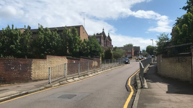
Transport for London says it is monitoring the effects of widened bus lanes between Charlton and Woolwich after over 2,000 people signed a petition calling for them to be removed.
The lanes have been widened between Anchor and Hope Lane and the Woolwich Ferry to assist buses and improve safety for cyclists, cutting the ordinary traffic lanes down to one in each direction.
In January TfL consulted on plans to build a segregated cycleway between Charlton and Woolwich, which would have had a similar effect, but after the coronavirus pandemic the route between Greenwich and Charlton was prioritised instead. Eventually TfL hopes there will be a continuous cycle route between Tower Bridge and Woolwich.
Bus lanes were widened as an interim measure – and introduced to Woolwich Church Street for the first time – to speed up services and to add some extra safety for cyclists. However, they have been blamed for increased congestion on Woolwich Road and Woolwich Church Street.
A petition created three weeks ago by Gagandeep Singh says there are “vehicles queuing up all day and evening”. By Thursday evening it had gained 2,359 names. One signatory claims it took them 90 minutes to travel between Woolwich and Charlton; another said: “It’s impossible to get out of the roundabout at Warspite Rd. Traffic jams are terrible all day long.”
While there has been a huge jump in traffic since the end of the first coronavirus lockdown, there has been congestion where drivers attempt to filter from two lanes to one at the junction with Anchor and Hope Lane. While the wider bus lanes – which replace narrow cycle lanes on Woolwich Road – allow cyclists to overtake buses at stops, they are not continuous. This means riders still have to take their chances with HGVs and other fast-moving traffic at roundabouts – despite the introduction of a 20mph speed limit on the route.
Two lanes merge into one at Anchor and Hope Lane
A Transport for London spokesperson told The Charlton Champion the widened lane had been introduced as part of its Streetspace programme “to create more space for people to safely walk and cycle”.
He added: “The bus lanes push general traffic and HGVs further away from cyclists; making this corridor a much more pleasant and less intimidating route, and provide a link from Woolwich into the Cycleway that is currently being built between Greenwich town centre and charlton. These lanes are an interim measure while we work on the permanent scheme that was consulted on earlier in 2020, and which would provide a two way segregated cycle lane taking people from Woolwich all the way into Greenwich, and eventually into central London.
“Bus lanes protect buses from congestion and ensure journey times and intervals between buses are more reliable. Bus lanes will help guard against a damaging car-led recovery by improving bus journey times and safety for Londoners making journeys by public transport and the increasing proportion travelling by bike.
“Changes made as part of the Streetspace programme are being introduced on a temporary basis under temporary traffic orders, and will be monitored after implementation to ensure they deliver the expected benefits. Monitoring along the A206 corridor will include reviewing cycle flows, perception of safety, collision rates, general traffic flows and bus journey times.”
The widened lanes do not run across junctions
He continued: “We are reviewing the operation of the bus lanes with the Royal Borough of Greenwich, and the data we are collecting is helping to inform these ongoing discussions. Where appropriate, adjustments to the scheme will be made if they aren’t performing how we expected. The new measures will be in place for up to 18 months, after which the monitoring strategy will form a key part of discussions between TfL and the council as to whether the scheme should be removed or made permanent.”
CYCLEWAY 4 PROGRESS
Woolwich Ferry to Anchor and Hope Lane, Charlton: Bus lanes as interim measure, funding for cycle route not yet certain
Anchor and Hope Lane to Farmdale Road, Greenwich: Work yet to start
Farmdale Road to Old Woolwich Road: Due to open early December
Old Woolwich Road to Old Royal Naval College: Uses existing routes
Old Royal Naval College to Norway Street, Greenwich: Awaiting funding application
Norway Street to Rotherhithe Tunnel: TfL in discussions with local councils, plans due in coming months
The TfL spokesperson said: “This is later than originally anticipated for a number of reasons, including delays in our supply chain for temporary materials, issues with ducting identified when on site and a recent design change to Vanburgh Hill bus stops to assist bus operations.
“We are currently finalising plans for the section of cycleway between Charlton and Anchor and Hope Lane and will announce our proposals and construction timescales shortly.”
A small section of Cycleway 4 is already open between Tower Bridge and Rotherhithe Tunnel; TfL said this week that plans for the section through Deptford would be announced “in the coming months”.
Network Rail first told Greenwich Council about its plans for the Angerstein Wharf branch crossing, across a freight line on the east Greenwich/Charlton border, in April 2018, emails released by the track company under the Freedom of Information Act show. Several council officers were involved in discussions and three site visits were held.
Councillors for Peninsula ward – who would have known of the importance of the crossing – were not told about the issue and neither was Greenwich & Woolwich MP Matt Pennycook, The Charlton Champion has established. The council maintains “there was nothing to tell residents” at the time.
A council officer dealing with conservation was also involved in a discussion about the planned closure in December and January 2019.
Network Rail sent the council a formal notice warning of the crossing closure on 14 February 2019, but the Valentine’s Day missive went unanswered until after a neighbour of the crossing used Twitter seven weeks later to say that residents had received letters about the closure.
Greenwich then threatened Network Rail with a injunction to prevent the closure of the crossing, which is used by hundreds of people each day heading to and from Westcombe Park station. It is one of a handful of foot crossings on London railway lines, and has grown in importance since new housing was built on the Charlton side of the crossing at Fairthorn Road.
The plans, which are to accommodate a resignalling of the line to and from the Angerstein aggregates wharf by the Thames, have now been put on hold.
A sign warning of the closure was stuck to a fence at the crossing
‘A full diversion is the way to go’
Network Rail first told Greenwich Council about the plans on 11 April 2018 – 12 months before neighbours found out. An unnamed member of Network Rail’s track renewals team warning that works were planned in May 2019 that “may affect the nearby foot crossing at Farmdale Road”, asking to set up a site visit. No response was received for a week until after the Network Rail officer sent a follow-up mail, after which a site visit was arranged by Greenwich’s street works area co-ordinator. An email sent from Network Rail after this visit states “I think we both formed the opinion that a full diversion is the way to go”.
After this, a further email from Network Rail which appears to have been sent to the planning team says “we need some assistance from yourselves to help us evaluate what we can do with the crossing to ensure public safety and rail transport safety”.
Responses include an email from one Greenwich Council officer to another stating “I don’t know what the Farmdale Road foot crossing is (level/bridge) as it’s not clear on the plan”.
On 9 May 2018, a planner responds to say: “The council would be likely to object to any closure since the route is well used by local people and by virtue that the passageway continues access over the A102 to Westcombe Park railway station, a route previously under threat when the A102 was built and with that the footbridge now seen over that road. NR could, of course, provide an alternative route in the form of a subway beneath its line.” A further site visit was held on 22 May 2018.
After that site visit, a council structures and street lighting manager emails with a summary of what was discussed, including plans for Network Rail to install CCTV as part of a risk assessment. But no further response was sent by Network Rail.
Network Rail has told The Charlton Champion: “After that meeting Network Rail undertook the process to understand the status of the crossing.”
‘Our closure of the foot crossing’
Separately, in November 2018, a Network Rail officer emails to comment on Greenwich Council’s plans to locally list the crossing – a mild form of protection against development – and states: “We would be happy to discuss with you further regarding the potential listing of these items and whether that is compatible with our closure of the Angerstein Wharf foot crossing.”
In mid-January 2019, a Greenwich officer emails to set up a meeting with their Network Rail counterpart. Network Rail has said this was followed by a third site visit to the crossing on 13 February.
Then on 14 February, a formal letter was sent by email warning of the closure of the crossing.
It promises: “We will erect clear signage either side of the crossing to make it clear when the closure will commence… As we have been in close liaison with you about these works, we wanted to inform you of this.” Greenwich Council says it did not receive this letter.
No response was received until 8 April – two days after a neighbour of the crossing tweeted about a letter he had received about the plans.
The tweet was included in the email. Meanwhile, the councillors and MP were finding out about the scheme for the first time through complaints from residents.
“I am not aware that Network Rail has notified the council directly of the proposed work,” the email states, while a further mail from the head of highways cites “a number of strong high level representations today objecting to the proposed crossing closure”.
A letter from Network Rail was placed in Fairthorn Road
The council then threatens an injunction, at which point Network Rail removes its plan to close the crossing. Asked what happened to the “clear signage”, a Network Rail spokesperson said: “The closure notice and information relating to the alternative route was displayed on the over bridge on the approach to the crossing and along Farmdale/ Fairthorn Road for the recent works and the Angerstein resignalling commissioning at Easter.”
A third site meeting was held on 12 April 2019 – a year and a day after the council was first told about the plan, and a few days before The Charlton Champion sent its Freedom of Information request – with an email from Greenwich Council confirming “that self-closing gates are to be installed to ensure that the public will be reminded that in opening these that they are at a level crossing”.
“I look forward to a copy of the letter bound for stakeholders and residents and further details of the works programme during the course of next week.”
The path is a popular route to Westcombe Park station
Councillors the last to know
Many current and former Greenwich councillors have long remarked privately that they are often the last to know about issues in their areas. Furthermore, the correspondence shows that officers were unaware of the crossing or its impact on the local area – which could also explain the council’s attitude to the consequences of the nearby Ikea store, where long-promised measures to assist pedestrians and cyclists have yet to be completed.
A Greenwich Council spokesperson told The Charlton Champion: “The council did not support Network Rail’s closing of the Angerstein Wharf crossing at short notice and with no consultation with residents in April 2019. When Network Rail made their initial enquiry to us in spring 2018 we were clear that they had not provided enough information of their plans.
“When we heard nothing further we assumed that their plans had changed and therefore there was nothing to inform residents of.
“The council has no record of receiving a formal closure notice from Network Rail in February 2019. If we had, we would have challenged their proposals and briefed our elected members then.
“In April we were as surprised as residents to find out what they had done. We swiftly instructed our legal team who persuaded Network Rail to postpone their plans. We will be meeting Network Rail next month and we will go prepared with legal advice regarding the status of the path and Network’s Rail statutory obligations to keep it open.”
The crossing will be closed over the weekend of 20/21 April
A senior Network Rail executive has written to The Charlton Champion apologising for its attempt to close the Angerstein Wharf foot crossing without consultation, and pledging to “rectify the situation”.
John Halsall, the senior managing director for Network Rail’s South East Route, said that the process it had followed “was not good enough” and it was committing to work with Greenwich Council and residents to work out the “best solution” for a line which is likely to see a rise in freight traffic.
The crossing, between Fairthorn Road in Charlton and Farmdale Road in east Greenwich, will be closed on 20/21 April for engineering works, but will remain open after that.
John Halsall’s letter reads as follows:
Can I start by apologising for the situation that we have generated with respect to the Angerstein footpath (Farmdale Road) crossing. We have approached what was a well-meant intervention, in terms of the safety of the public, in the wrong way, and for that I am sorry.
We are working out how we can rectify the situation, within the bounds of our statutory obligations to protect the safety of the public. I can confirm that as a first step we will not be permanently closing the footpath crossing immediately after the bank holiday weekend of 20/21 April 2019. We will need to block the crossing over that weekend as we undertake engineering works, to protect the public from engineering activity, but the crossing will not be permanently closed at that point.
Over the last 18 months we have engaged with the local authority, but it would appear not always with the right part. Clearly this process has not been good enough, and we are therefore committing to work closely with the Royal Borough of Greenwich and local residents to establish the best solution we can collectively achieve while meeting our statutory safety obligations.
I need to reiterate that we have embarked upon the process for the best of reasons. The risk to the public at the crossing will increase due to engineering changes that are being made following previous operational incidents and also with the anticipated increase in freight traffic. We take this matter very seriously.
I sincerely apologise once again for the poor engagement and will update you further when we have a clear plan confirmed with the local authorities and local residents.