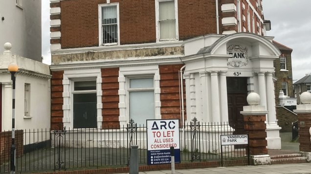
A Plumstead-based brewery is hoping to turn the former Barclays branch at the Royal Standard into a “beer café” – just weeks after the bank closed its doors for the final time.
Common Rioters has submitted a planning application to Greenwich Council to change the building’s use – the first stage in a journey it hopes will end with its own bar and place to brew its beers.
The three-year-old brewery, run by Stephen and Maryann O’Connor, takes its name from the Plumstead Common rioters, whose revolt in 1876 saved the open space from being destroyed by a developer.
They had originally hoped to take on a unit at the Jack’s Acre development on Rochester Way in Eltham, but when that fell through, Stephen told The Charlton Champion that he spotted the Blackheath bank building was being let.
“We’re into learning about historical and modern styles of brewing coupled with peoples’ history,” he said. “Not yet having a commercial brew kit or place to brew means that until now we’ve relied on friends in the industry to brew our beers with. Our beers have been available at a select few pubs in the area and at our Plumsteadshire stall, which pops up in various locations as well as online. Following the theme of our stall somewhat we intend to have guest brewery appearances at our pub alongside many other non-beer items for enjoyment.
“The opportunity to bring The Green Goddess to Blackheath in an iconic building was too good to miss.”
Common Rioters’ interest in the bank comes less than two months after it closed. Barclays announced it was shutting the branch – the last bank at the Royal Standard – in October, and it closed its doors on 15 January. Nearby, the former NatWest branch has not yet found a tenant nearly three years after the state-owned bank pulled out of the area.
The brewery is currently selling beers from other suppliers though its online shop, with free delivery in SE7 and other Greenwich borough addresses every Friday.
While all pubs are closed because of the lockdown, there have been hopeful signs for SE7 drinkers looking for a decent pint once the restrictions have passed, despite the loss of the White Swan a year ago.
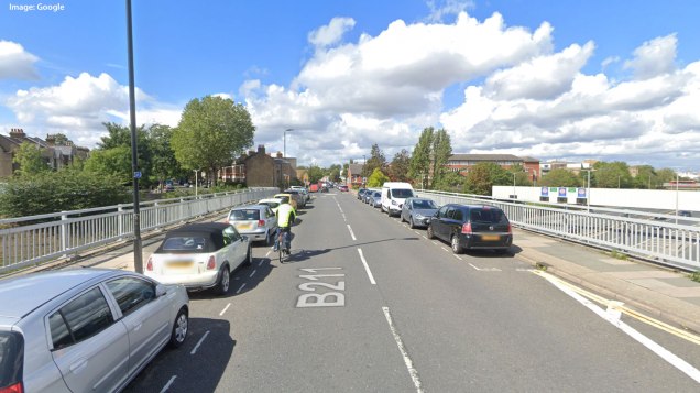
Old Dover Road, seen here in this Google Streetview image, could be closed at the A102 bridge
Plans to make cycling safer for schoolchildren could see through traffic banned from Old Dover Road, according to plans unveiled by Greenwich Council yesterday.
Cameras could be placed on the bridge over the A102 to stop cars, vans and lorries from heading down the full length of the road as part of the proposal to finish a proposed cycle route from Shooters Hill Road to Greenwich Park.
The council also plans to put a camera on Banchory Road to stop the rat-running that has blighted the short-cut to and from Charlton Road for years, with HGVs transporting cars to the Metropolitan Police’s pound on Bramshot Avenue continuing to thunder down the dog-leg into Craigerne Road.
Traffic would still be able to use Old Dover Road, but drivers heading to the shops would have to enter from the Royal Standard if the proposals go ahead. Using cameras means buses and emergency services can still use the route, while closures could be limited to rush hours or daytimes only.
Part of the cycle route, from Baker Road to Weyman Road, was finished last year, but now the council is consulting on proposals to extend it west along Shooters Hill Road, and then to route riders along a quieter Old Dover Road, before the route continues along St John’s Park towards Blackheath.
However, rather than following an existing footpath to Greenwich Park, cyclists would be expected to turn left into Vanburgh Terrace and then right into Maze Hill – the top section of which would be closed to through traffic – before reaching the park.
The route was chosen as it runs close to or past five different schools: Greenwich Free School, Halley Academy, Leigh Academy Blackheath and John Roan School. It is one of two routes to be chosen for funding by Transport for London – the other is a cycle route from Eltham to Greenwich Park, which is also being consulted on.
Sizwe James, the council’s cabinet member for transport, said: “These routes will help more people cycle more often, even more safely, and help us with our green recovery. Whether it’s for shopping, commuting to work, getting to school or for leisure these routes have the potential to make cycling a serious option for more people.
“Travelling by bike is much cheaper than driving and these cycle routes will open the borough up so residents can travel further, more confidently. Not only is cycling easy on the wallet it’s good for our health and everyone around us too. If you’re serious about putting the brake on unnecessary car journeys, avoidable chronic health conditions caused by car exhausts and climate change then please have your say.”
Last month Greenwich announced a scheme which would involve cutting through traffic in Westcombe Hill: many Charlton residents have recently received anonymous leaflets urging them to protest against the proposals, and promoting a website which also does not reveal who is behind the campaign. Two weeks ago the council told The Charlton Champion it would monitor any effect the scheme had in Charlton and would take action if necessary.
Progress is also well under way on the extension of Cycleway 4 along Woolwich Road into Charlton, a scheme which is being delivered by Transport for London rather than the council.
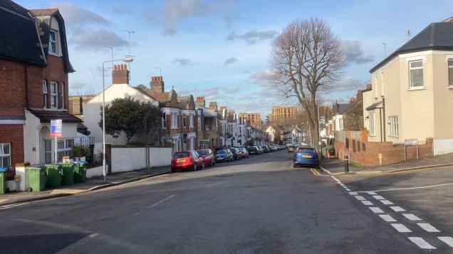
Residents in Eastcombe Avenue regularly complain of rat-running traffic
Greenwich Council says it will monitor the effects of closing Westcombe Hill to through traffic on neighbouring streets in Charlton and take action if necessary.
Maze Hill has been particularly badly hit since the upsurge in traffic following the first wave of the coronavirus pandemic, as well as similar traffic measures in west Greenwich and in Greenwich Park. Westcombe Hill is often used as an alternative to the six-lane motorway-standard A102, which runs alongside it.
Similar schemes across London – aimed at tackling a long-term increase in motor traffic in London, much of it borne by residential roads; as well as to make it safer for people to walk and cycle when public transport is restricted – have proved highly controversial, with often bitter campaigns for and against them. The west Greenwich scheme, which saw streets around Royal Hill and Hyde Vale blocked with planters, saw competing petitions both for and against the scheme and misleading claims that the ambulance service had objected. Two opposing campaigns have sprung up in Greenwich: Greener Maze Hill and Greenwich Gone Too Far.
A camera will be placed on Westcombe Hill to restrict traffic
This scheme will see cameras put in place on Maze Hill, Vanbrugh Hill and Westcombe Hill; planters will be installed on Halstow Road. One option mentioned on an online consultation is to make the measures only operate in the rush hour, with free access at other times.
While most schemes are clearly aimed at making back streets safer, many drivers will consider the three roads with cameras as main roads – particularly Westcombe Hill, which older motorists will remember as the main route to the Blackwall Tunnel until the late 1960s and is served by four bus routes.
Responses to the council’s proposals on its consultation website have been overwhelmingly hostile, although it is unclear how many respondents live within the affected area and how many are drivers from outside who object to the upheaval of taking a different route. In the Blackheath Westcombe ward which makes up the south of the area, 36 per cent of residents do not have a car – a figure that rises to 48.8 per cent in Peninsula ward to the north, which suffers the most from congestion.
One risk of the Maze Hill and Westcombe Park scheme is that traffic will simply move to another rat-run – Eastcombe Avenue and Victoria Way, which are already blighted by traffic heading to and from the Charlton retail parks. TfL analysis given to councils last summer indicated that Charlton and the western part of Woolwich was the area of Greenwich borough most suited to hosting a low-traffic neighbourhood.
This rat-run via Victoria Way is unaffected by the new scheme
There are no formal plans at present to deal with the rat-running in Charlton, but the council’s cabinet member for environment, sustainability and transport, Sizwe James, said the new scheme was “just the start”.
Asked if the council had contingency plans in place if that happened, the cabinet member for environment, sustainability and transport, Sizwe James, said: “During the experimental period we would assess any impact on surrounding areas including the Eastcombe Avenue and Victoria Way routes. Schemes can be improved, and additional measures put in to reduce traffic on other residential streets.
“Due to funding arrangements, we cannot work on all areas at once, but we have got more proposals in the pipeline for other areas which we will be consulting on soon. This is just the start.”
He said the consultation was for “initial proposals” and added: “Any measures would be implemented as an experimental scheme with a full consultation forming part of this process.”
Westcombe Hill is paralleled by the six-lane A102
“Our proposals are based on traffic analysis and concerns about increasing traffic raised by local residents. We’re collecting residents’ views on traffic levels in recent years, whether levels have increased and how residents have been affected,” he said.
“If we don’t act now traffic will only continue to get worse. It has already doubled over the last decade in London and in our borough alone between 2014 and 2019 the number of miles driven on our roads increased by one hundred and thirty million.
“People who choose to drive through residential areas are disproportionately affecting everyone’s quality of life – due to air and noise pollution, speeding and illegal parking.
“The proposals would not stop anyone from using their car if they want or have to, but would direct vehicles on to the main roads that were designed to carry them in the first place.
“Why should the health of our residents and in particular our children be at the mercy of drivers who do not even live in the borough taking short-cuts through residential areas because that’s what their mobile sat-navs told them to do. It may even make people question what their first choice of transport is if they feel safer walking, cycling or wheeling because their streets are no longer dominated by heavy traffic.
“If we want to reduce the amount of people with heart disease, osteoarthritis and cancers caused by inactive lifestyles or asthma and respiratory diseases caused by car exhausts then we have to be brave and we have to begin somewhere. The gases from these vehicles are causing a third of all our emissions too – making the planet warmer and directly contributing to climate change.”
With the shift to online banking, Barclays says “only 232 customers use this branch exclusively for their banking”, while 28 per cent of the branch’s customers already use other branches.
After the last day of trading on 15 January, the nearest Barclays branches to Charlton will be in Blackheath Village and Woolwich.
Charlton’s own branch of Barclays, next to Charlton station, was demolished in the late 1990s as part of work to create a transport interchange for the Millennium Dome.
The Barclays branch in Deptford High Street – an old Woolwich Building Society branch – is also closing, on 11 January; the branch at Rotherhithe will shut its doors five days earlier. (See a full list of branches that are closing.)
You can beat the queues at Sainsbury’s… at a cost
Living near a load of supermarkets has its downsides – litter, dumped trolleys, rat-running – but if you live within about three kilometres of Sainsbury’s at Charlton Riverside, the store giant wants to make your life a little easier.
The store is now offering one-hour deliveries through the Sainsbury’s Chop Chop app – select up to 20 goods, and they should come to you within an hour. The scheme has been trialled with bicycles in the Southwark area – we wait to see whether Sainsbury’s staff will be puffing up Charlton Church Lane with your last-minute shopping, or dicing it on the Woolwich Road.
This all comes at a cost – delivery is £4.99, so competitive with taking a minicab, although there are some opening offers; your first order is free if it’s over £15. Watch for the price of goods too – our keen-eyed Charlton Champion consumer expert has noticed some goods are more expensive (1.25 litres of Coke Zero currently £1 in store, £1.15 on the app).
Of course, you could walk to the store and get a bit of exercise – but if you’re in a hurry, or it’s raining, this could come in very handy if you’re happy to pay extra.
Three kilometres takes in Greenwich and Woolwich town centres and Blackheath Village, so there’s bound to be a lot of demand. We haven’t tried it yet, but we’d be interested to hear from readers who have – the comments are open. You can download the app at chopchopapp.co.uk.
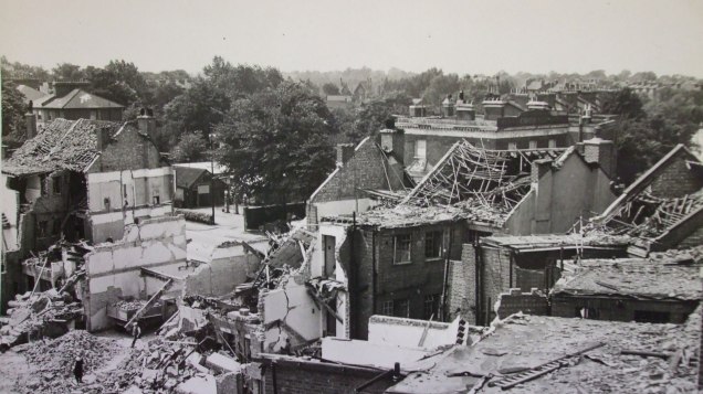
The damage to Stratheden Parade, opposite the Royal Standard in Blackheath
As we mark the 75th anniversary of VE Day, still under lockdown, there are still plenty of reminders of our wartime past in the area. Many of them are hiding in plain sight. Historian STEVE HUNNISETT takes us on a Second World War trail to show you what there is to discover in and around Charlton.
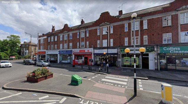
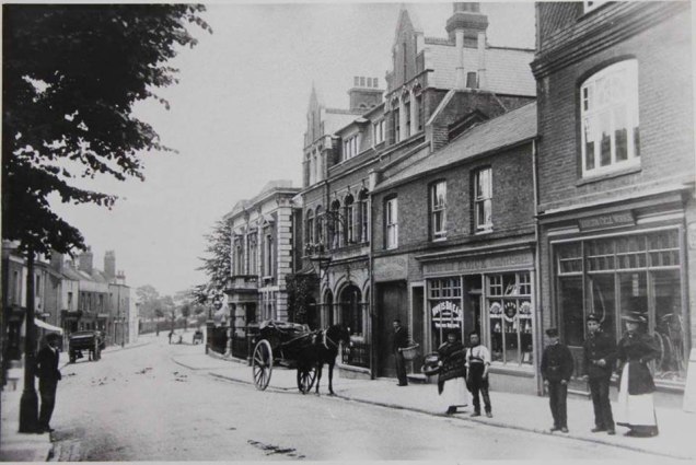
We start our walk adjacent to the Royal Standard pub. Take a look at the arcade of shops that we know as Stratheden Parade. These were rebuilt after the war, replacing those destroyed in a V-1 flying bomb incident on 21 June 1944.
Stratheden Parade in 2019 (image: Google)
The photo at the top of this tour below shows the scene immediately afterwards. You can just see the top of the Royal Standard peering above the ruins in the right middle distance.
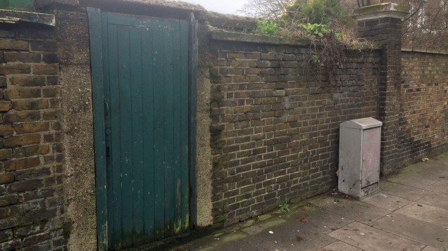
As we set off along Charlton Road, heading towards SE7, you can see an innocuous-looking wooden door by the bus stop.
An innocuous-looking door on Charlton Road…
Step back slightly, and you will see a concrete slab roof. If you venture into the car park of Bernard’s Club (Combe Lodge), you will see a concrete structure that looks to be at a slightly odd height. This is due to the car park level having been built up over the years.
…what’s behind the wall
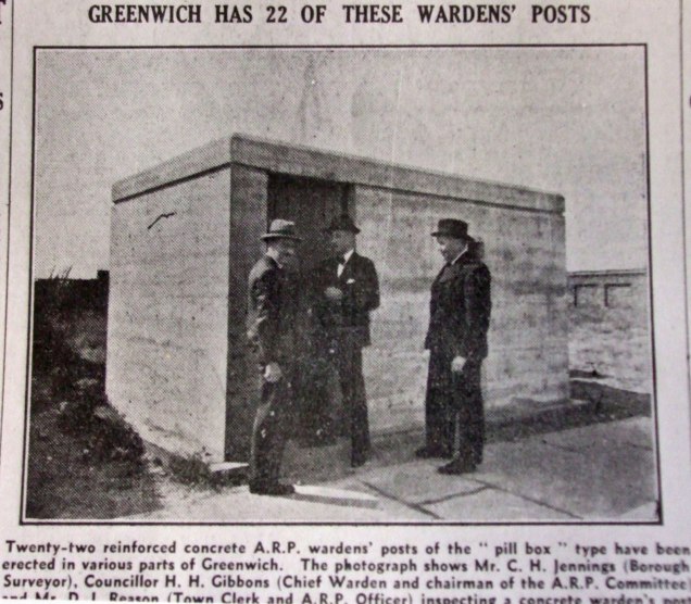
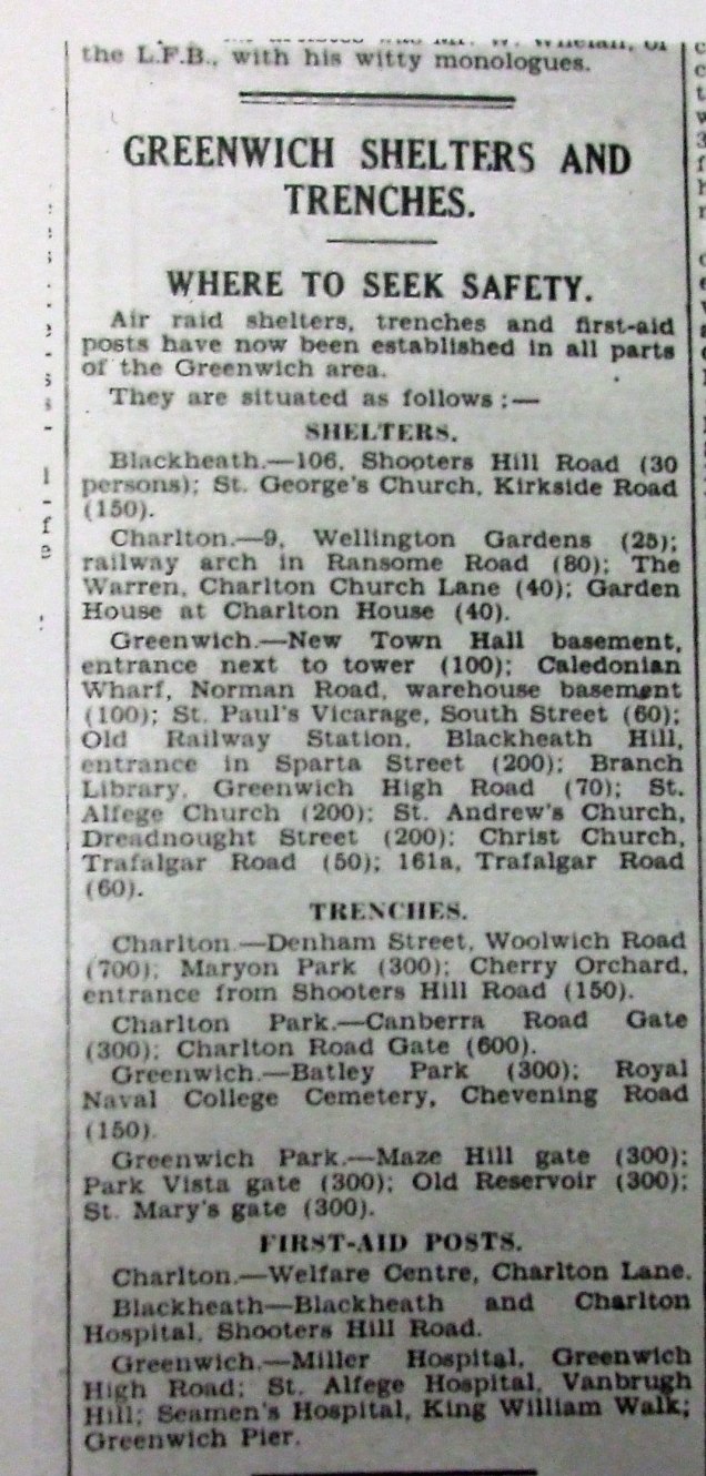
This is the former air raid precautions (ARP) wardens’ Post “Park 20” of the Metropolitan Borough of Greenwich. These were a standard design, as the contemporary newspaper article shows us. This post was one of a network across the borough that housed the air raid wardens who patrolled a local beat during air raids, acting as incident officers to co-ordinate the response to individual bomb incidents.
“Is that a light?”
During “all clear” periods they would continue their patrols, and would be on the lookout for infringements of the blackout – no doubt telling local residents in true Dad’s Army style to “put that light out!”
If you cross the road and take a brief detour into Invicta Road, it might be possible to catch a glimpse of a commemorative plaque in the school playground, fixed to one of the surviving walls of the original school building.
The plaque was erected in 2017
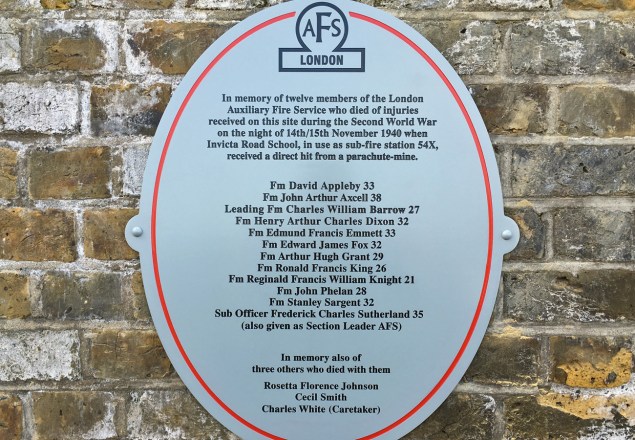
The plaque tells us that the school, whose wartime pupils had been evacuated to the safety of the countryside, was in use as Station 54X of the Auxiliary Fire Service. On 13 September 1940, one of the firemen based there, Arthur Grant, had been awarded the George Medal for his bravery in removing a 50kg bomb that had fallen through the roof of the school without exploding. He had carried it into the playground and covered it with sandbags to reduce the effects of any subsequent explosion. When the bomb did eventually explode, the damage caused to the buildings was minimal.
Sadly though, on the 14 November 1940, a parachute mine exploded which devastated the school buildings and killed 12 of the firefighters based there, as well as three civilians, including the school caretaker. Arthur Grant’s George Medal had been announced two days previously and he died without having the chance to have it awarded to him.
The damage to Invicta Road School
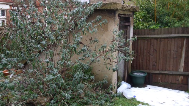
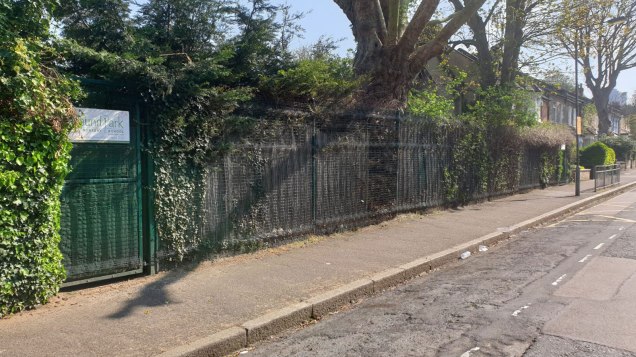
We’ll resume our walk along Charlton Road, but pause by the entrance to the Rectory Field. If you peer through the fence of the adjacent dental surgery, you can see a concrete structure in the garden. This is the entrance to a substantial air raid shelter. The reason that the house had this in the garden, rather than the standard Anderson shelter is that the house and the one next door to it had been requisitioned by the Army to house some of the guns’ crews for the anti-aircraft guns that were on the sports fields. (The shelter is usually filled with surplus furniture from the dental surgery, so cannot be accessed at present, although I will keep trying!)
The shelter behind Charlton Dental Surgery
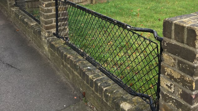
As we continue our walk, we swing right into Marlborough Lane. About halfway along on the right-hand side, we can see some examples of wartime “stretcher fences”. These were originally manufactured by the hundreds of thousands and were known as ARP stretchers, for use by the Air Raid Precautions service to deal with the expected mass casualties from any enemy air attacks.
Stretcher fences in Marlborough Lane
Fortunately, casualties were far lighter than expected and the vast majority of these stretchers were never used in anger. With the coming of peace, in an early example of recycling, the stretchers were used as railings, in many cases replacing wrought iron railings that had been sacrificed for the war effort in the production of steel.
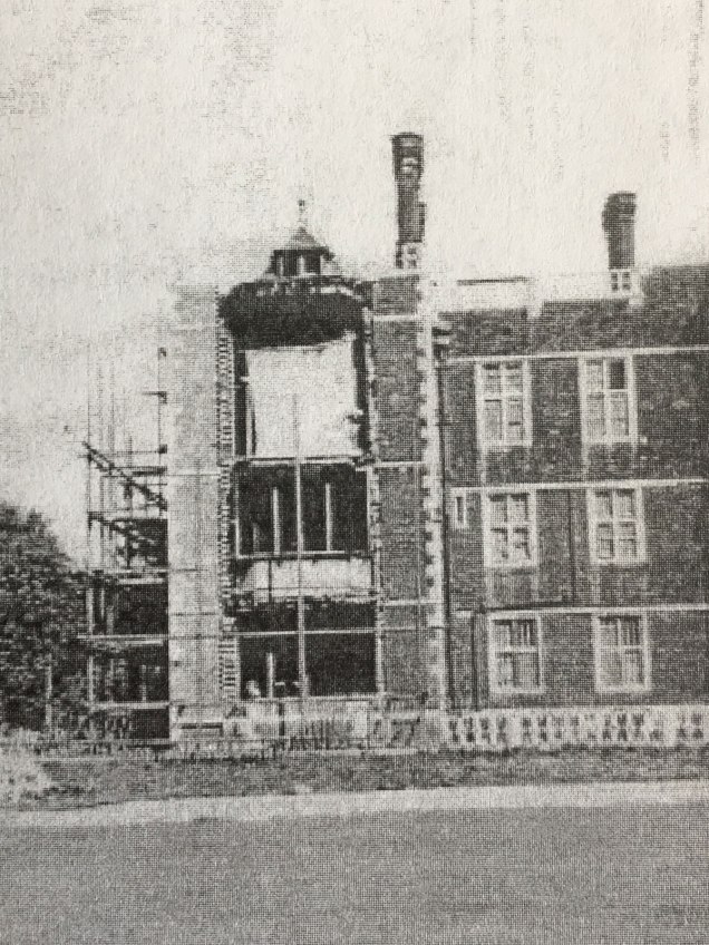
From here, continue a short distance along Marlborough Lane, turn left into Sutlej Road and right into Canberra Road, before turning left into Hornfair Road. You will soon see the magnificent Charlton House on your right. Completed in 1612 for Sir Adam Newton, it subsequently became the home of the Spencer-Maryon-Wilson family.
The wrecked wing of Charlton House
During the Great War of 1914-1918, it had been requisitioned for use as a military hospital and following the war, was purchased outright by the Metropolitan Borough of Greenwich for use as a library and as the borough museum. During the Second World War, the basement was used as an air raid wardens’ post. On 25 January 1945, the house was “near missed” by a V-2 rocket, the blast from which demolished much of the Chapel Wing. Repairs were made after the war but shortages of materials meant that non-matching bricks of a different size and colour had to be used, which today gives us a vital clue as to which part of the building was destroyed and which is the original.
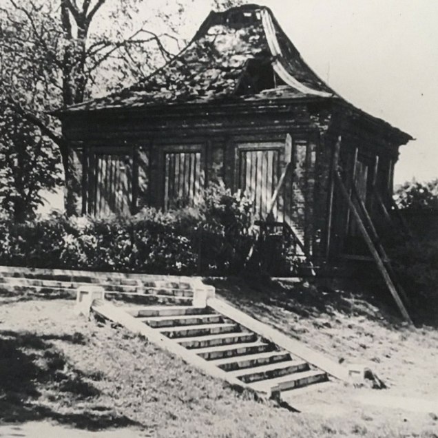
The summer house following the bomb
If we cast our eyes towards the attractive summer house, we can compare views with the building as it is now but also immediately following the V-2 blast, which left it in a state of near-collapse.
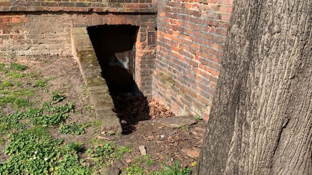
The entrance to the old Charlton summer house shelter
At the bottom right of the summer house, visible behind the fence that rings off the mulberry tree, can be seen a slightly obscured entrance. This was earmarked for use as an air raid shelter in 1939 and appears in the list published in the Kentish Independent at the outbreak of war. It was allegedly capable of housing 40 people but it is unclear whether it was ever actually used as such and it was certainly out of use by the time of the V-2 attack in 1944.
As we exit the park and turn right heading into The Village, we see opposite us St Luke’s Church and the War Memorial, in the shape of the Sir Reginald Blomfield-designed Cross of Sacrifice. The present St Luke’s dates from 1630 and the tower, which could be seen from the Thames, was once used as a navigational aid to ships using the river. As the church is entitled to fly the pre-1800 Naval Ensign on St Luke’s and St George’s Days.
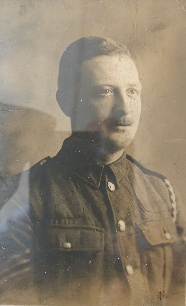
The tower was also used for firewatching duties during the Blitz and my grandfather, William Henry Beresford (seen here in his Army days), a local air raid warden, was frequently stationed here at that time.
William Henry Beresford, Steve’s grandfather
As you continue in to The Village, pause opposite the White Swan pub, now sadly closed since just before the lockdown began and the future of which remains uncertain. If you compare the pub in as-built form and how it appears today, you can see that it has a slightly truncated look to it. This was a result of events on the night of 17 October 1940, when a high-explosive bomb destroyed the Siemens Social Club, which once occupied the site now occupied by the more modern arcade of shops. The blast from this bomb also rendered the once-ornate top part of the pub unusable and in danger of collapse, leaving the pub with its present appearance.
The original White Swan with ornate upper floor and Siemens Social Club next door. Meridian Sports Club in Charlton Park Lane is the successor to the Siemens club
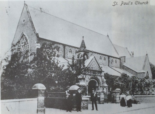
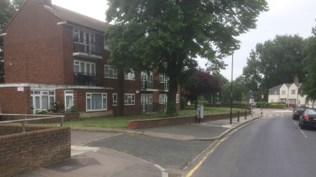
Now turn left from The Village into Fairfield Grove and pause at the junction with Charlton Lane. Today this is the site of an unassuming apartment block named St Paul’s Close. On this site once stood St Paul’s Church, which dated from 1867 but which has the sad distinction of being the first church in London to have been destroyed by enemy action during the Second World War.
St Paul’s Church as it was St Paul’s Close today
This came on 4 September 1940, before the “official” start of the Blitz when at 21:40 a single aircraft dropped a bomb at low level which hit the church, almost completely destroying it. There were no casualties but the church was deemed to be beyond repair. The following day, large crowds came to view the ruins but the novelty of such sights was soon to wear off. Some artefacts from the ruined church were salvaged and are now in St Luke’s Church, but the only remaining clue here lays in the name of the apartment block.
The site of the bombed houses on Charlton Lane
Continue down Charlton Lane but before you turn left into Harvey Gardens, pause and look into the near distance on the opposite side of the road, before the junction with Pound Park Road. This area is now part of the garden for the school, but in 1940 this was the site of a row of five houses. On the night of 8 December a high-explosive bomb demolished the houses, trapping five people inside.
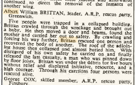
A rescue squad under the command of Albert Brittan soon arrived. Brittan decided to enter the ruins. Crawling through the rubble, he soon found a baby and brought it to safety. He went back in and found the baby’s mother, freed her and brought her to safety also. Going back into the ruins a third time, he rescued a third person and recovered the body of a fourth. Whilst he was doing this, the roof of one of the buildings collapsed and almost buried him. Undeterred, he carried on his work and freed another man who was pinned down. Brittan spent almost five hours in the ruined building and continued working with no regard for his own safety.
For this act of incredible bravery Brittan, who lived in Deptford and who had been a bus conductor before the war, was awarded a George Medal, as this extract from The Times of 26 April 1941 informs us.
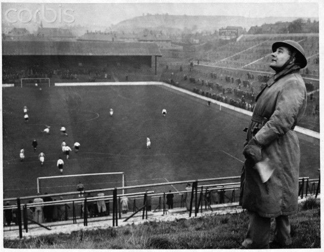
As you head into into Harvey Gardens, you will walk behind the Covered End of The Valley, which was hit on 16 October 1940 leaving a hole in the roof of the stand. The repairs to this were visible right up to when the stand was replaced with the present structure in the early 2000s. The photograph taken at the opposite end of the ground shows the arrangements that were in place for wartime football, with a “spotter” stationed high on the terraces; his job was to alert the referee using his large flag, in the event of enemy aircraft being seen approaching. The match would then be abandoned whilst the fans took cover in local shelters.
This famous image of wartime football was taken at The Valley
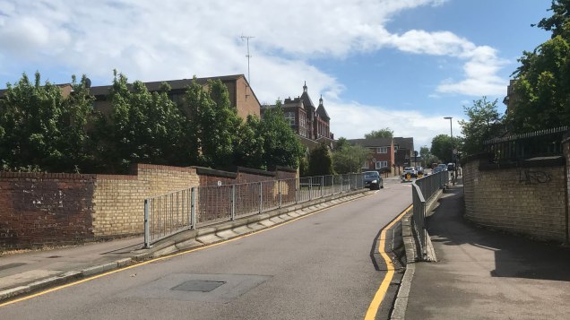
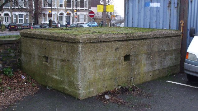
One shelter that was nearby was located at the railway arches at Ransom Road. These were extended with a brick and concrete structure so as to be able to accommodate eighty people. However, this type of shelter was not popular with the public, for the dual reasons of safety and sanitation, or the lack thereof.
The Ransom Road shelter was built out to the right of the bridge
Continue along Floyd Road and turn right into Charlton Church Lane for our final port of call, which is outside Charlton station. Today it is an uninspiring late 1960s structure, built in the former British Railways’ “Clasp” style of construction. Older residents might remember the shambolic appearance of the station before the present buildings were constructed, which resembled a collection of wooden and corrugated iron huts.
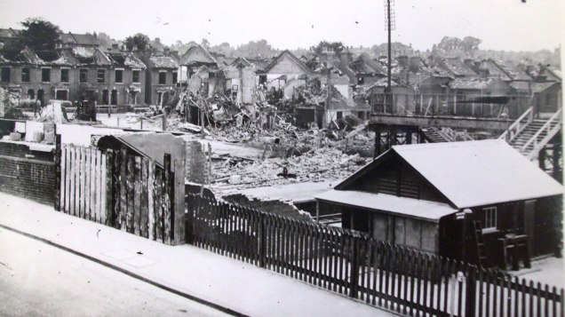
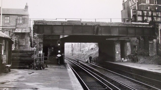
Charlton station a few weeks after the bomb
This was the legacy of a devastating V-1 flying bomb attack on 23 June 1944, when the station buildings were completely destroyed by a direct hit. Considering that the missile hit the station during the afternoon, it is perhaps surprising that only four people lost their lives in this incident, including Mrs Newick, the wife of the station master. Another 30 people were seriously injured in the incident, which left surrounding houses severely damaged by the blast.
Charlton station still bore its war scars until well the late 1960s – this picture was taken in 1961
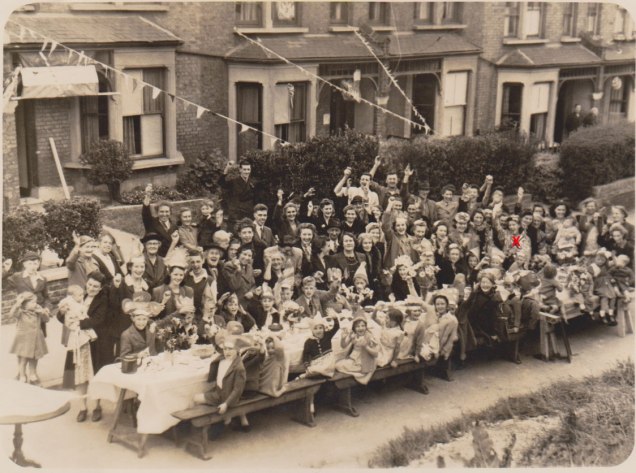
Victory was hard earned but when it came, street parties erupted all across London, including in our own neighbourhood. To conclude, it seems fitting to return almost to where we began and to observe the street party held in Invicta Road on either the 8th or 9th May 1945 – I wonder if any of those small people enjoying the newly-found peace are still with us?
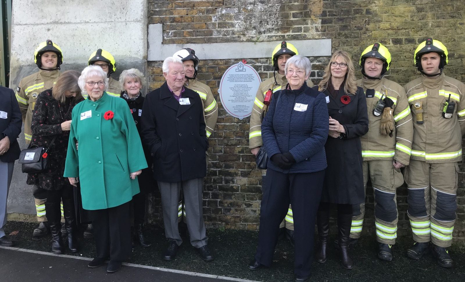
Fireman Harry Dixon’s family joined East Greenwich’s White Watch at the ceremony
Children at Invicta Primary School gathered this afternoon to remember the 15 people who died when the school was bombed during World War II.
Year 2 children joined White Watch from East Greenwich Fire Station for the short ceremony, 79 years to the day after the then Invicta Road School – which was being used as a fire station – was destroyed by a parachute mine which fell into trees opposite the school before exploding. Twelve firefighters and three others died.
Among those at today’s ceremony were members of the family of Harry Dixon, one of the firefighters who died that night.
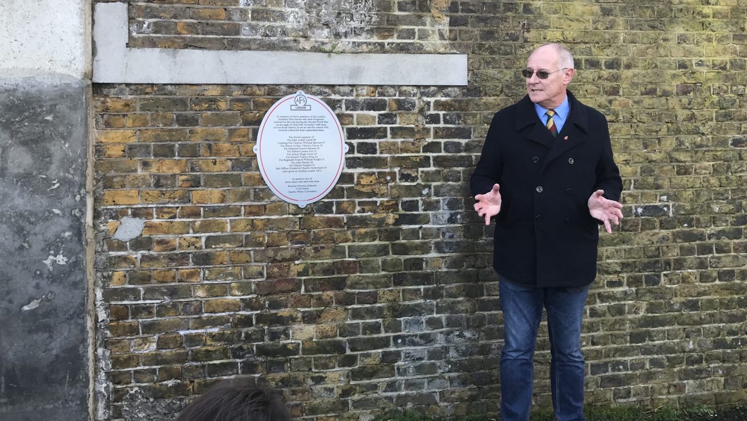
Steve Hunnisett led the ceremony at Invicta Primary School
Local historian Steve Hunnisett led the ceremony, which came as the Year 2 children spent a day learning all about World War II. Steve was also on hand to talk to the children about the war, showing them shrapnel, an air-raid whistle, a gas mask and other items; while the firefighters also took questions from the children.
The plaque was installed at the school in 2017 by Firemen Remembered, an independent organisation devoted to raising awareness of the work of the fire services during World War II. It is on a Victorian wall at the back of the playground, the only remaining part of the original school. The replacement 1950s buildings were demolished in 2016 when the current school opened on the site of the old playground.