The consultation into the Charlton Riverside masterplan closed last week. The big plan was to write something a few weeks back picking out a few interesting things from the three chunky documents that make up the masterplan. Then real life intervened.
But it’s still worth a canter through the masterplan – because if you plan to stick around in or near Charlton over the next decade or so, this will affect you. It’s actually a thoughtful document with much going for it. Huge developments are now springing up on the Greenwich Peninsula, in Woolwich, and across the water at Silvertown, where residents of Royal Wharf will have a lovely view of the Anchor & Hope. Now it’s our turn.
The plan is for 5,000-7,500 new homes (50% family housing, 35% “affordable”), mostly low to medium rise (3-6 storeys) developments, 4,000 additional jobs, expanding the park at the Thames Barrier and linking it to Maryon Park, and downgrading Woolwich Road west of Anchor & Hope Lane. Activity will start first nearer the barrier – but this will be is a very long-term process.
There are three big documents – the Charlton Riverside Draft Masterplan itself, the Draft Employment and Heritage Study, and Draft Woolwich Road Highway and Public Realm Improvements. Everything here is based on what’s in those documents, with a few ideas thrown in for discussion.
Change of approach?
The first point to note is that this is a slightly broader area than Charlton itself – it stretches to Horn Lane, at the edge of east Greenwich, to take in the wharves and freight railway line; but stopping just short of the extended Greenwich Millennium Village and proposed Ikea. To the west, it goes out to Warspite Road in Woolwich, while the heritage study goes further into the old Woolwich royal dockyard site.
The second point is that this marks a change in approach by Greenwich Council. And this isn’t just in recommending fairly low-rise development – up to ten storeys. Past masterplans have effectively been left to the market – the Greenwich Peninsula masterplan was essentially written by the lead developer, Knight Dragon; Berkeley Homes effectively controls the Woolwich waterfront east of the ferry.
But here, Greenwich is seeking to take a more active role in starting development. Whether this is an acknowledgement of recent mistakes or a reaction to a different set of circumstances, it doesn’t say, although part of it is about making sure the risk of flooding around the Thames Barrier – where the council is keen to get things started – is properly dealt with.
It’s not just here that Greenwich is seeking to flex its muscle – the scheme to build a cinema in Eltham High Street comes straight from the town hall, as does the plan to revelop the battered old Woolwich public market. But this is much bigger, and not all of it may come off as planned.
Indeed, there’s already a threat to the draft masterplan in the Rockwell plan for Anchor & Hope Lane – 28 storeys rather than ten. But there is a get-out clause – ““tall buildings may be appropriate so long as there is adequate public transport and consideration is given to existing historical assets and distinctive characteristic features”. Does this apply on Anchor & Hope Lane?
For Woolwich’s shops to live again, Charlton retail must die?
Retail barns in Charlton aren’t a new thing – the first to open was Makro, in March 1974. (Sainsbury’s got a foothold before that, opening its original depot up the road four years earlier.)
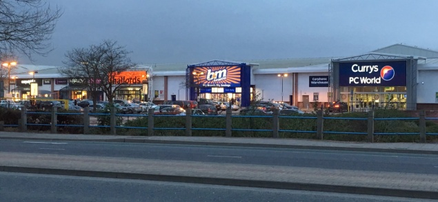
They’ve even begun to cannibalise themselves – the Greenwich Shopping Park and Sainsbury’s/M&S sit on the sites of 1980s retail/industrial units, as will the delayed Brocklebank Retail Park, due to open later this year.
None of it is safe under the masterplan – “the existing retail does not conform with [council] policy”, it says, even if these sites were only given permission a few years ago. Few councillors representing Greenwich’s strand of the Labour party will apologise for allowing development that they think will allow employment, even if it’s at the expense of the surrounding environment. But Greenwich’s planners must now be hoping Charlton has hit Peak Retail.
You don’t have to look too far to sense an ulterior motive – the long decline of Woolwich as a shopping area, for which one culprit is the retail barns in Charlton. As long ago as the early 1980s, Greenwich objected to Asda coming here because it wanted to protect Woolwich, and as recently as 2011, Woolwich Riverside councillor John Fahy made the same complaints about the relocated Sainsbury’s store.
Greenwich councillors still hanker after Woolwich being designated a “metropolitan centre”, like Bromley or Stratford. Instead, it’s a “major centre”, along with Eltham, Lewisham, Catford, Canary Wharf and Bexleyheath. The GLA agrees Woolwich could be bumped up a league – which would delight councillors eager to get one over the old enemy in Bexley. One way to achieve that could be for some of that retail floorspace to leave Charlton and return to SE18.
In any event, the retail can adapt to survive – homes and offices can always be built on top of retail premises, just as Tesco did in Woolwich. In Hackney, the council is buying the area’s Tesco superstore to redevelop it while keeping space for the supermarket. Could a project like this come to Charlton?
Balancing employment, heritage and housing – an impossible ask?
Think you know Charlton’s riverside? Think again. I guarantee you will learn something new if you leaf through the heritage and employment study, which contains fascinating case studies of the businesses on our doorstep.
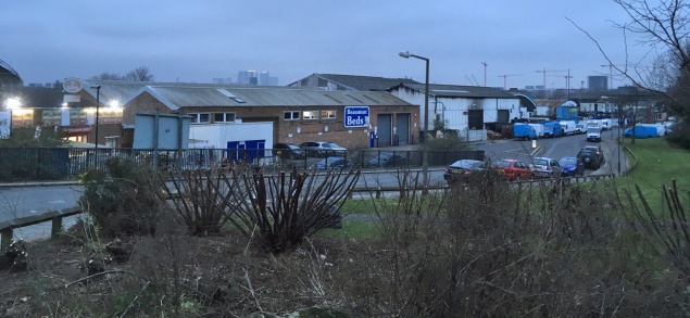
5,600 people are employed by the river and the plan is to keep it that way. But with many in manufacturing (18% of businesses) and vehicle repair (13%), how many of these can remain? The Blackwall Tunnel is seen as both a blessing and a curse by many firms – but with increased pressure on the road network, it’s hard to see how these can co-exist with mass homebuilding.
To the west, Angerstein and Murphy’s wharves are assumed to be staying in use – should the businesses close, the study suggests the railway line alignment leading to the yards is kept for possible passenger use.
The idea here seems to be to develop the artistic and creative uses that have developed around Thames-Side Studios. But with public transport access fairly poor, is this really a goer?
But there’s a strong emphasis on making more of the rich history of the Charlton riverside, possibly a reaction to the near-complete erasure of much of Greenwich Peninsula’s industrial heritage.
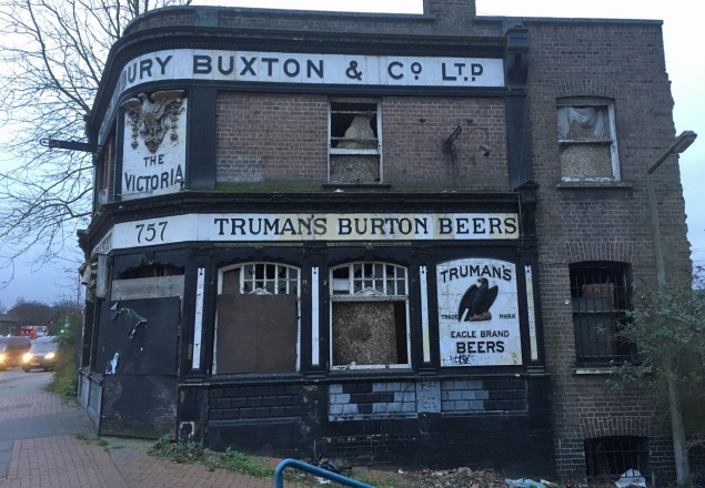
Buildings recommended for listing include somes of the old Siemens buildings (partly used by Thames-Side Studios) and the Corys boatyard – even though the council gave the firm permission to knock it down four years ago. It’s suggested the Victoria pub facade is retained and the site put to a new use. Interestingly, the surviving small shop on the north side of Woolwich Road – London & Kent Electrical, whose owner refused to move when the Sainsbury’s/M&S site was being developed – is also recommended for listing.
One thing missing from the heritage study is the area’s sporting links – a huge omission is the founding of Charlton Athletic at Siemens Meadow, in the heart of the area now up for redevelopment, in 1905. There is also no mention of the greyhound stadium which sat on Anchor & Hope Lane from 1928 to 1971.
It’s all about the infrastructure
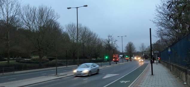
but its East London sister service survives in Dagenham and Ilford (Photo from Julian Walker via Creative Commons CC BY-NC-ND 2.0)
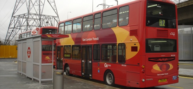
The plan sees a new road being driven through from Anchor & Hope Lane towards Woolwich Road to serve the new developments – but this would not be an alternative to Woolwich Road, which seems peculiar when one of the wishes of the masterplan is to see part of the A206 downgraded so it only serves local traffic. Instead, it would be used by a revived Greenwich Waterfront Transit, the segregated bus scheme axed by Boris Johnson in 2008.
But with North Greenwich station due to come under increasing pressure – and the Greenwich Peninsula itself to get more crowded – expecting or encouraging people to commute via there may be an unrealistic ask. It’s hard to know quite what the answer is, though, without getting a crayon out and drawing a line that will cost billions.
There are more fundamental flaws than this – there’s nothing about linking the riverside to north of the river beyond suggesting a riverboat pier; a study by architect Terry Farrell last year proposed a low, lifting bridge for public transport, pedestrians and cyclists for roughly Anchor & Hope Lane – that doesn’t feature. Nor is there anything about relocating Woolwich Dockyard station, which would enable the platforms to be lengthened and for it to better serve the regeneration area.
Woolwich Road wonders
There are big dreams for Woolwich Road. “The aim is to create a high quality and attractive urban boulevard shared by pedestrians, cyclists and vehicles with improved connectivity between the riverside area and the existing community of Charlton.”
But improvements to Woolwich Road are – in the short term at least – being stymied by the mayor’s office: Sadiq Khan’s TfL budget cuts mean the planned Cycle Superhighway 4, due to run to Woolwich, will only go as far as Greenwich town centre by 2020. Greenwich was hoping to use this to fix some of the A206’s lethal junctions at east Greenwich and Anchor & Hope Lane; we’ll now have to wait.
There are two set-piece ideas suggested: one is to replace long-standing plans for a “green bridge” across Woolwich Road at Maryon Park with a “green crossing”. This would be cheaper and would calm the traffic on Woolwich Road down, providing a safer way for children at nearby schools to cross the road.
The other looks at the bus terminal outside Charlton station, originally constructed in 1999 for Millennium Dome buses. The report suggests it could return to being green space or find some other use – but this glosses over the fact that it’s still used by short-running buses and rail replacement services. It would also kibosh local lobby group Transport for Charlton’s desire to have the 472 loop around here to serve Charlton station.
So what happens next?
Now the consultation is over, Greenwich Council will amend the masterplan to incorporate anything which comes up that it agrees with, then it’ll become a part of the local planning framework, and it’ll be used to guide development in the area over the coming years. We’ve been talking about the riverside for years, but it finally looks like things are about to happen down there.
These are always difficult processes – a masterplan requires you to think big, but local councils only have so much power. And even though Charlton Riverside is on City Hall’s radar, will a skint Transport for London be able to deliver the improvements needed to help it flourish?
We’ll have to see what happens with the Rockwell Anchor & Hope Lane plan – if that gets through, the plan for Charlton Riverside may end up being just that, a plan, as developers make hay. It may not seem that way when you wander down by the river, but the next year or so is going to be be crucial in terms of deciding what will happen down there.

Couple of things – glad you like the history bit, and see my commercial below
but first – with the whole of the North Charlton area its worth seeing which developments were forced on us all by the Planning Inspectorate. My impression is that a lot of it is there because of their ruling which can overturn the Council’s decisions. The one I really know about is the flats on the Johnson and Philips site, at the end of Fairthorn Road where the Council Planners refused consent twice and then were told they had to agree it by the DOE’s Planning Inspectorate (who, incidentally, I was told, broke their own rules in the process).
So – the commercial – Greenwich Industrial History Society has a talk on the report into the history of the Charlton Riverside on 13th June at 7.30 Age Exchange Bakehouse
(before then we have Jon Wilson on the British in India on 23rd May)
Mary